Section 5
Rothbury to Kirkwhelpington
 (15 miles / 24 km)
Download GPX file
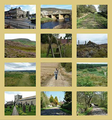
The picturesque and ancient village of Rothbury is set in the Coquet valley and surrounded by hills. St. Oswald’s Way leaves the River Coquet here and heads southwards again, this time over remote but appealing country.
The route enters Northumberland National Park and passes the remains of an Iron Age hill fort and rock carvings at Lordenshaws.
The heather-clad moors of the Simonside Hills are crossed before reaching Harwood Forest, a large plantation managed by the Forestry Commission.
The route then crosses attractive farmland to reach the settlement of Knowesgate and the scenic small village of Kirkwhelpington.
You can watch a video of this stage here and an aerial tour of the route here. Both are kindly provided by David Steel of Plan Watch Walk, a Northumberland based walking resource.
Walk link – https://youtu.be/ZNklrjwXLsI
Aerial tour link – https://youtu.be/h-N8Xoz6DnY
