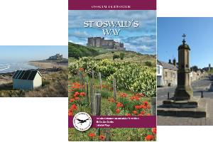
The Official Website
  • St Oswald’s Way
    • Holy Island to Bamburgh
    • Bamburgh to Craster
    • Craster to Warkworth
    • Warkworth to Rothbury
    • Rothbury to Kirkwhelpington
    • Kirkwhelpington to Heavenfield
  • Short Walks
    • Coast
      • Bamburgh 3.5m (6k)
      • Bamburgh & Burton 7m (11k)
      • Beal & Fenwick 5.5m (9k)
      • Belford 3m (4.5k)
      • Belford & Detchant 5.5m (9k)
      • Holy Island 3m (5k)
      • Warkworth (two routes)
      • Warkworth & Amble 5m (8k)
    • Country
      • Felton (two routes)
      • Great Whittington 5m (8k)
      • Heavenfield & Wall 3.5m (5.5k)
      • Kirkwhelpington 3m (5k)
      • Pilgrimage to Heavenfield 4.5m (7.5k)
      • Rothbury 7.5m (12k)
      • Rothbury and Newtown 4.5m (7.5k)
      • West Thirston 3m (5k)
    • Easy Access
      • Bamburgh 2m (3k)
      • Belford 1m (1.6k)
      • Craster 2.3m (3.7k)
      • Great Whittington 1.9m (3.1k)
      • Holy Island 2m (3k)
      • Kirkwhelpington 1.9m (3k)
      • Rothbury 1.2m (2k)
      • Warkworth 2.4m (3.9k)
  • Shop
  • Route Changes
  • Stay
  • Service Providers
  • TV & Radio
  • Contact us
  • Please donate

Long Distance Walk

St. Oswald's Way walking routes in Northumberland

Click on the map to enlarge

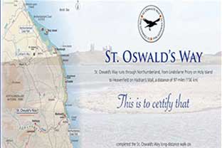
St Oswald’s Way is a long-distance walking route, exploring some of the finest landscapes and fascinating history of Northumberland. The route links some of the places associated with St. Oswald, the King of Northumbria in the early 7th Century, who played a major part in bringing Christianity to his people.
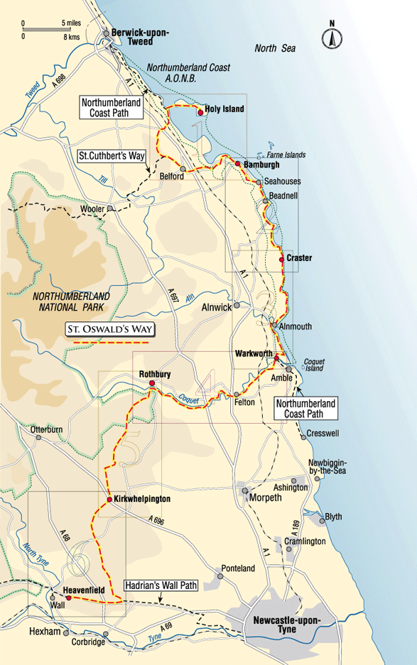
From Holy Island (Lindisfarne) in the north, St. Oswald’s Way follows the stunning Northumberland coast, before heading inland across beautiful countryside to Heavenfield and Hadrian’s Wall in the south, a distance of 97 miles (156 km). You will find castles, coastline, islands, scenic river valleys, hills, attractive villages, forest and farmland on your walk.

St. Oswald’s Way Walking Route is divided into six sections from north to south:

1. Holy Island to Bamburgh (19 miles / 31 km)
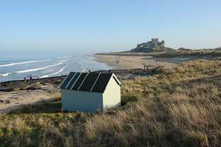
2. Bamburgh to Craster (14 miles / 22 km)
3. Craster to Warkworth (13.5 miles / 21.5 km)
4. Warkworth to Rothbury (18 miles / 29 km)
5. Rothbury to Kirkwhelpington (15 miles / 24 km)
6. Kirkwhelpington to Heavenfield (17.5 miles / 28.5 km)

You can, of course, walk the route in different sections or in the opposite direction.

If you are planning to walk St. Oswald’s Way and need accommodation, please contact Berwick Tourist Information Centre on this page.


Also of interest

  • short walks in northumberland
    Short Walks
  • route changes on St Oswald's Way
    Route Changes
  • apply for certificate
    Apply for certificate
  • Buy St Oswald's Way Merchandise
    Shop
  • Find accommodation on St Oswald's Way
    Stay
  • Win a Cotswold Outdoor voucher
    Win a £100 voucher
  • Please donate to help improve our route
    Help improve our route
  • Service providers along St Oswald's Way
    Service Providers
  • St Oswald's Way on TV and radio
    TV & Radio

Like us

  • Route Changes
  • Stay
  • Service Providers
  • Contact us
  • Please donate
  • Win a £100 voucher
© St Oswald's Way